REACH
Project Summary
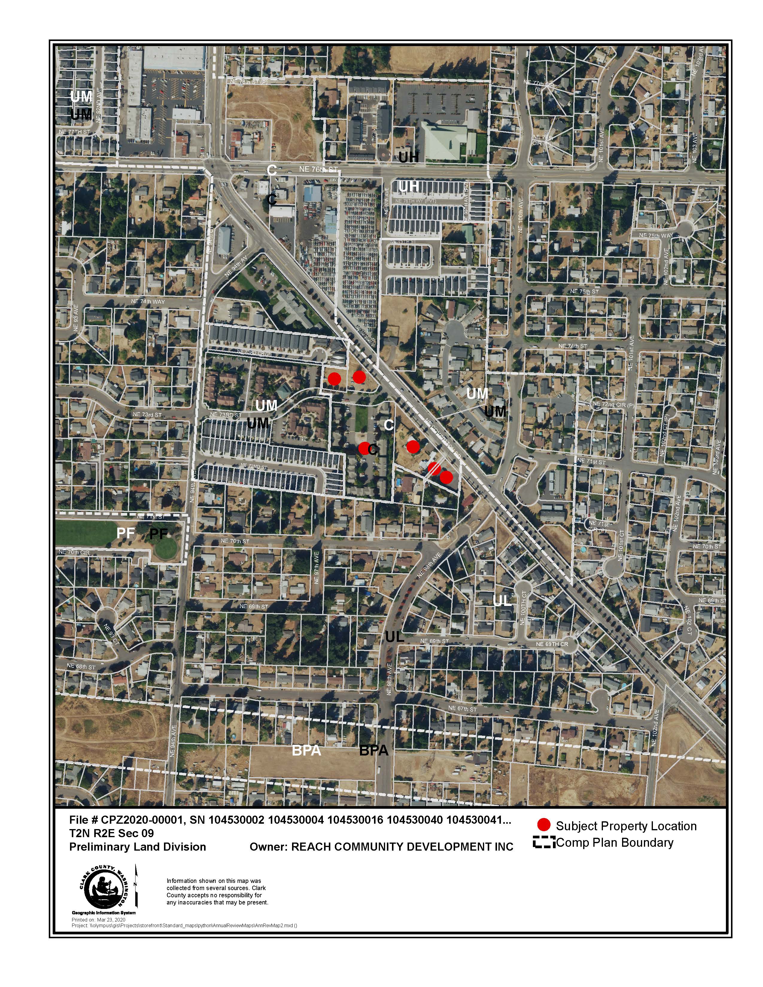
This is a proposal to amend the comprehensive plan and zoning map designation from Commercial (NC) to Urban Medium Density Residential (R-22) on three parcels, which are cumulatively 3.11 acres (104530004, 104530040 and 104600000). This amendment would enable Reach Community Development, Inc. (Reach CDI) to expand additional affordable housing units on the two vacant parcels adjacent to existing housing that serves low-income households in Clark County. As part of this request, two adjacent property owners are requesting to participate in Reach CDI’s request to amend the comprehensive plan and zoning map designations on their parcels from NC to R-22 (104530016, 104530041, and 104530002). These three additional parcels total 1.1 acres. The total cumulative acres of this request are 4.21 acres.
Background
Reach CDI, the non-profit sponsor, owns Covington Commons Limited Partnership (Covington Commons LP), which consists of three parcels that are zoned Commercial (NC). One of the subject parcels (104530004) has eight existing residential buildings with 40 affordable housing apartments, ranging in size from one to four-bedroom units. The other two parcels are vacant (104530004 and 104530040). The three subject parcels have had the Neighborhood Commercial comp plan and zoning designation since 1994 and the existing apartment buildings on parcel 104530004 were constructed between 1998 and 2000.This is a proposal to amend the comprehensive plan and zoning map designation from Commercial (NC) to Urban Medium Density Residential (R-22) on six parcels, which are cumulatively 4.21 acres (104530004, 104530040, 104600000, 104530016, 104530041, and 104530002). R-22 zoning is “intended to provide for medium density residential development based upon consistency with the comprehensive plan and compatibility with surrounding land uses.” [CCC 40.220.020].
The proposed comprehensive plan and zoning amendment would enable Reach CDI to develop 15-20 additional affordable housing units on the two vacant parcels to complement the existing affordable housing that serves low-income households in Clark County. Having the same comprehensive plan and zoning designations on all properties would assist Reach CDI with completing their resyndication process by placing all three developments into one tax credit.
As part of this request, two adjacent property owners are requesting to participate in Reach CDI’s request to amend the comprehensive plan and zoning designations on their parcels from NC to R-22 (104530016, 104530041, and 104530002). These three additional parcels total 1.1 acres. The total cumulative acres of this request are 4.21 acres. One of the property owners (104530002) is in discussion with Reach CDI about the purchase of their property so that Reach CDI can include this parcel in their affordable housing development.
Staff Contact
Public Meetings
Meeting information and project materials will be posted here.
Planning Commission Meetings
Oct. 15, 2020 Planning Commission Hearing at 6:30 p.m.
- Presentation for Reach, Hidden Glen & Promenade North
- DNS
- Staff Report
- Zoning & Aerial Maps
- Transportation Impact Analysis
- Signed Covenant
- Supporting Documentation
Oct. 1, 2020 Planning Commission Work Session at 5:30 p.m.
County Council Meetings
Jan. 19, 2021 County Council Hearing
- Planning Commission Recommendation
- Planning Commission Minutes (pages 50-54)
- Maps
- Transportation Impact Analysis
- Signed Covenant
- SEPA
- Supporting Documents
Jan. 6 County Council Work Session
