Hua-Symes Annual Review
Project Summary
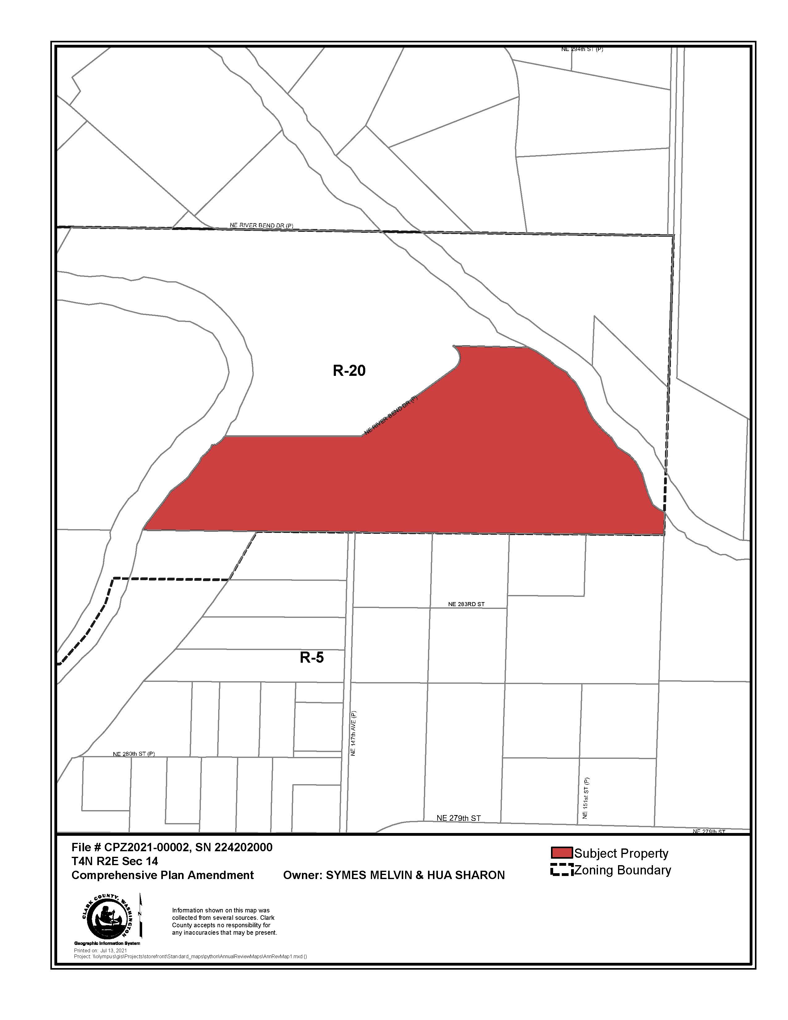
The applicant is requesting to amend the comprehensive plan and zoning map designation from Rural 20 (R-20) to Rural 5 (R-5) on one parcel that is 24.7 acres (224202000).
Background
The applicant owns one parcel (224202000) that is designated Rural 20 (R-20) and is located at 28501 NE River Bend Drive, Battle Ground, WA 98604, approximately a quarter mile north of the intersection of NE 147th Ave. and NE 279th St. The subject parcel is approximately 1.9 miles Northeast of the Battle Ground city limits.
The subject parcel was purchased by the applicant in April 2020. In 2021, the county issued a building permit for construction of one single family residence and a detached garage on the property, to be occupied by the applicant (NHC-2020-01684).
The East Fork Lewis River abuts the parcel on its eastern and western edges. There are landslide and severe erosion hazard areas on the property related to slopes exceeding 15% and areas of potential instability. The property also includes riparian and non-riparian habitat.
Comprehensive plan and zoning designations surrounding the subject parcel are Rural 20 and Rural 5. Properties to the north, west and east of the subject parcel are primarily Rural 20. Properties to the south of the subject parcel are primarily designated Rural 5.
The applicant is requesting to amend the comprehensive plan designation and zoning from Rural 20 (R-20) to Rural 5 (R-5) on one parcel (224202000). The subject parcel is 24.7 acres per the county Assessor’s GIS data. If rezoned to R-5, the site could potentially be subdivided into 5 lots, 4 more than the current R-20 zoning allows.
Both Rural-20 and Rural-5 zoning are “intended to provide lands for residential living in the rural area. Natural resource activities such as farming and forestry are allowed and encouraged in conjunction with the residential uses in the area. These areas are subject to normal and accepted forestry and farming practices.” [CCC 40.210.020]. Residential uses are emphasized to a greater extent with the Rural-5 designation, whereas a Rural 20 designation “applies to rural areas where the lands act as a buffer to Natural Resource designated lands, are used for small scale forest or farm production or contain significant environmentally constrained areas as defined by applicable county code and related regulations” [2016 Comprehensive Plan, page 36].
Public Meetings
Meeting information and project materials will be posted here.
County Council Meetings
March 1, 2022 at 10:00 a.m., County Council hearing via Webex with CVTV live streaming - Please visit the County Council meeting page for info on how to participate in the hearing.
- Planning Commission Recommendation Memo
- Maps
- Transportation Impact Analysis
- Planning Commission Minutes-11/18/2021
- Public Comments
- Applicant Submittal
- SEPA
- Supporting Documents
- Interactive Map
- Presentation
Jan. 19, 2022 at 9:00 a.m., County Council Work Session via Webex - Please visit the County Council meeting page for info on how to participate in the hearing.
Planning Commission Meetings
November 18, 2021 at 6:30 p.m., Planning Commission hearing via Webex with CVTV live streaming - Please visit the Planning Commission meeting page for info on how to participate in the hearing.
- PC Minutes
- PC Recommendation
- Staff Report
- Maps
- Transportation Impact Analysis
- Public Comments and Correspondence
- Application Package
- SEPA
- Supporting Documents
- Interactive map
- Public Comments Received
- Power Point Presentation
November 4, 2021 at 5:30 p.m., Planning Commission work session via Webex - Please visit the Planning Commission meeting page for info on how to listen to the work session.
