Groth
Project Summary
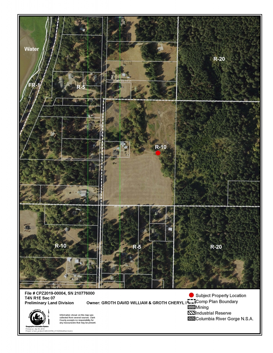
The applicant is requesting to amend the comprehensive plan designation and zoning on one parcel (PIN 210776000) with a total of 26.29 acres from Rural 10 (R-10) comprehensive plan designation with Rural (R-10) zoning to Rural 5 (R-5) comprehensive plan designation with Rural (R-5) zoning.
Background
The applicant owns one parcel (201776000) that is designated Rural 10 (R-10) and is located north of NW 304th St. and east of NW 71st Ave. The subject parcel was previously owned by Clark County Public Works and was considered as a potential sand and gravel resource, but it was determined that it did not fulfill that need and was surplused and sold to the current owner in 2016 via public auction. The parcel was selectively logged under a forest practices permit (FOR2017-000388). There is a natural gas easement on the property for a petroleum pipeline.
The properties to the north, south, and west are zoned R-5, with the exception of two smaller parcels to the west (201801000 and 210809000), which are surrounded by the subject parcel on three sides. Both parcels are zoned R-10 and are under one acre. The property owner has submitted a letter stating that they are not interested to participate in this re-designation request.
The subject parcel abuts parcels to the east that are owned by Clark County Legacy Lands. Parcels 210783000, 201784000, and 210785000 were initially purchased in anticipation of the county trading them for 320 acres surrounding Mud Lake (now called Lake Rosannah) with the Morgan Family (Plas Newydd Ranch). That exchange never came together and the county plans to harvest timber from these three parcels at some point in the future as part of its sustainable forestry program. Parcel 210783000 (35 acres) and parcel 210785000 (5 acres) are both zoned R-10, while 201784000 is zoned R-20 (40 acres).
The applicant is requesting to amend the comprehensive plan designation and zoning from Rural 10 (R-10) to Rural 5 (R-5) on one parcel (210776000). The subject parcel is 26.29 and if rezoned to R-5, could potentially be subdivided into 5 new lots (3 more than the current R-10 zoning allows).
Public Meetings
Sep. 17, 2019 – Clark County Council Hearing
On September 17, 2019, the county council approved the request (4 to 1) to amend the comprehensive plan and zoning on one parcel (PIN 210776000) with a total of 26.29 acres from Rural 10 (R-10) comprehensive plan designation with Rural (R-10) zoning to Rural 5 (R-5) comprehensive plan designation with Rural (R-5) zoning.
- PC Recommendation
- Maps
- Transportation Analysis
- PC Minutes
- Application Submittal
- Public Comment (09/11/2019)
- Public Comment (09/17/2019)
- SEPA
- Supporting Documents
Aug. 15, 2019 – Planning Commission Hearing
Aug. 1, 2019 – Planning Commission Work Session
Information and tips on providing testimony (public comment)
