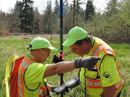
Submitting a record of survey, subdivision or short plat for review and recording.
Private property surveys
Clark County does not survey private property and cannot recommend professional surveyors. To find a surveyor, please refer to online resources. Search for a recorded survey: Survey Finder
Surveys
Surveys are submitted directly to the County Surveyor’s Office for review and recording.
This office requires a paper copy be submitted for preliminary review/redlining. If a paper copy is not submitted, redlines will be made directly on the Mylar. The reviewed copy will be available for pickup at the Surveyor's Office Records Center. There is no charge for the review process.
A review copy may be sent via email in a PDF or similar format to: surveyreview@clark.wa.gov. However, there will be a charge per the fee schedule below for the Surveyor’s Office to print a copy for review, and return via email. This fee will be payable at the time of Mylar submittal. Please note this email address is only for submitting a Record of Survey for review.
After the required corrections, if any, are made, submit a Mylar for recording, along with the recording fee and the original reviewed copy. Please make checks payable to: Clark County Surveyor’s Office. Mylar and checks may be delivered to the Surveyor’s Office, Fourth Floor, Public Service Center, 1300 Franklin St., Vancouver, WA, or mailed to:
Clark County Surveyor’s Office
Fourth Floor, Public Service Center
P.O. Box 9810
Vancouver, WA 98666-9810
If you need copies of the recorded Mylar, you may send a paper copy(s) to be marked as the recorded survey or, for a per copy fee, we will photocopy the recorded Mylar.
Subdivisions, short plats and condominiums
The County Surveyor's Office provides a review of subdivisions, short plats and condominiums per the checklists below, as part of the overall submittal and review process required by Clark County Community Development or by the incorporated city in which the plan is located. There is no additional charge for the County Surveyor's Office's review of subdivisions and short plats. Search for a recorded subdivision: Subdivision Information Browser
Road Books
The majority of Clark County’s roads were created by the road establishment process. The proceedings were logged into thirteen Road Books for official record. Access county road establishment book images: Road Books
Survey Records Fee Schedule (effective July 25, 2021)
Payment for Recording surveys will only be accepted at the time the reviewed and approved Mylar is presented for recording. Advance payments are not accepted. Payments must be for the full and exact recording fee plus any copies required/requested. Checks of incorrect amounts will be returned and the Survey not recorded until correct payment is submitted.
Recording fee is subject to change, please call the Surveyor’s Office for the current Recording Fee (564) 397-4228
| Service | Fee |
|
|
$428.50 |
| Affidavit of Correction Recording Fee | - |
| Land Corner Record, Recording Fee |
No charge |
| Certified Copy, First Page Each Additional Page |
$3 $1 |
| Non-Certified Copy (up to 11”x 17”) Each additional page of multi-page Document |
$1 $0.25 |
| Certified large format copies (larger than 11 inches x 17 inches) Each additional page of multi-page Document |
$6 $4 |
| Large format copies (larger than 11 inches x 17 inches) |
$4 |
| CDs (Various sets of Records, per request) |
$25 + $10 per CD |
| Update CD for Existing set (ROS, Plats, LCR’s) |
$10 per CD |
For more information, please contact:
Percenia Flora
Records Assistance and General Information
564.397.4228
percenia.flora@clark.wa.gov
John Besancon, PLS
County Surveyor
564.397.5130
john.besancon@clark.wa.gov
Related links
Clark County Community Development
Washington State Public Land Survey Office
Land Surveyors' Association of Washington
Statewide Survey Control Database
Bureau of Land Management (BLM)
National Geodetic Survey
