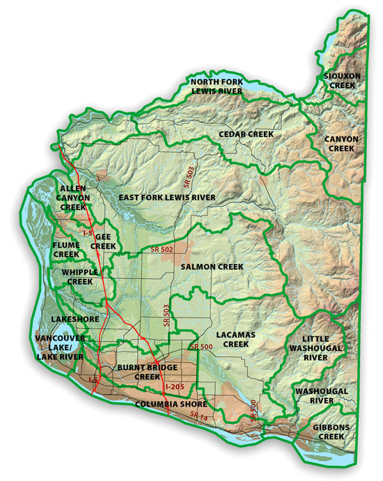
From 2006 to 2010, Clark County used the Stormwater Needs Assessment Program (SNAP) to assess watershed conditions, identify problems and opportunities for stormwater projects, and recommend strategies to meet the department’s mission of strategically protecting and enhancing the natural environment.
A set of assessment and monitoring techniques were used in watersheds across the county. Problems were identified and lists of potential projects were developed for evaluation.
The SNAP completed its five-year cycle in March 2011 and produced 36 reports summarizing stormwater system information, available scientific reports and overall conditions in county watersheds. Although stream and watershed conditions change over time, SNAP reports provide a recent compilation of background watershed information. To request copies of the reports, please call 564.397.4345.
Highlights from this effort include:
- 80 miles of stream corridor inventoried and assessed for problems.
- 15 stormwater projects scheduled for construction by 2012.
- 100 stormwater facility issues scheduled for maintenance.
- 30 streamside trash dumps removed.
- 90 landowners contacted with information to help them solve problems.
Clark County Watersheds
What watershed do you live in?
Visit the County's GIS mapping system MapsOnline. 1) On the Layers tab, turn on the Watershed layer. 2) On the Find Parcel tab, enter your address and click Find. 3) On the Layers tab, turn on the black "information icon" in front of the Watershed layer and then click on your parcel. The watershed name will appear in the upper left hand corner of the page.
